 |
| The West Toronto Railpath was part of my original bike commute |
My original commute took me along the West Toronto Railpath, Davenport, and Caledonia before turning off at Glencairn onto some residential streets before work. While I always enjoyed riding along the Railpath, Caledonia is a rough place for bike commuting. Between St. Clair and Eglinton, there are two valleys with a very tough hill to climb just south of Eglinton. The road widens once you get to the employment lands past Castlefield Avenue, which bring the trucks along with it. The traffic on Caledonia can also be heavy, which can be a blessing – speeding past cars on my way home – and a curse with a serious collision happening at Caledonia and Glencairn recently. Surely, there is a more pleasing way to get around than Caledonia?
 |
| Map of my original bike commute along the Railpath, Davenport, and Caledonia |
 |
| A dead end exists on Winona north of St. Clair |
 |
| There is no way to legally go northbound from Winona and Belvidere |
 |
| Going home via Marlee-Winona-Shaw is relatively direct. Can't say that for heading to work. |
 |
| The City of Toronto wants to extend this northbound bike lane on Vaughan Road |
 |
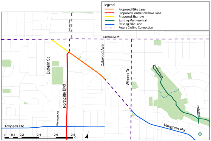
| Map of Oakwood neighbourhood connections (via City of Toronto) |
Last, but not least, what is this “no walking or cycling” sign doing at Vaughan and Winona? There’s no highway near there that would require this sign.
Longitudinally yours,
Rob Z (e-mail)

No comments:
Post a Comment